Spiral Jetty Trip Report
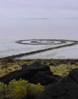
The Spiral Jetty (1970), by Robert Smithson is an early prime example of Earthworks sculpture. It is located on the North shore of the Great Salt Lake in Utah, at Rozel Point. For many years it was completely under water. A couple years ago we learned that a change in lake water management (something about the railway levee acting as a dike and disrupting the eco-system) and/or a long running western drought has brought the work seasonally above the fluctuating surface. Fall is often a good time to visit as the water level is down, the roads are usually dry, and the weather is cooler.
We planned to go this fall, even though the dry summer meant the lake had long ago dropped below what we felt was an optimal water level. The target weekend arrived with forecasts of rain and snow. This could be a problem because the site is accessible only via rough high desert back roads, which might be impassable when wet. Knowing that forecasts are often wrong, and not having another free weekend before winter sets in, we took a chance and drove to Salt Lake City.
Arriving midday Friday, we entertained ourselves at our favorite restaurants and shopping for items that cannot be purchased where we live. The next day, before setting out, we stocked up on fresh fruit at the Farmer's Market, our last opportunity to buy local summer fruit. While the weather was overcast and threatening, it was dry. We headed North towards Ogden. Soon, it started raining, then snowing. It wasn't looking too promising. We decided we could visit the Golden Spike National Historic Site as an alternate activity if the Jetty could not be reached.
Since one passes Golden Spike on the way to the Jetty, we enquired there about road conditions on the way to the Jetty. After dire warnings of doom from the Park Service staff, we decided to just poke around at Golden Spike and take the rail bed driving tour. As we were about to purchase the little tour booklet, we were informed the tour "was closed due to snow." This was odd, as the valley was clearly snow free, though there was snow quite low on the surrounding mountains.
It being not even lunch time, we decided to drive towards the Jetty to the point where the road condition first deteriorates, just to see how bad this portion was, knowing it gets worse the closer you get. Turns out, this 'bad' class D road is a perfectly serviceable all weather gravel road where one could easily drive 40 mph. We got within 3 miles of the site before the road condition changed. Even at this point, it didn't look too bad, as the road still had evidence of gravel being put down many years ago.
It appears the Park Service now has a policy of discouraging visitors to the Jetty site because if some bonehead gets in trouble, the Park Service gets stuck having to rescue them. Understandable, but misleading visitors is not winning them any goodwill points either. In our opinion, considering that we are talking about un-maintained back roads, in the rain, the conditions were rather good. The following is our take on the road conditions, but keep in mind it is just our opinion of what we experienced that day, conditions can change quickly with time and weather. Also, it depends on your frame of reference. We encountered some naïve art lovers who had inappropriately parked their vehicle, blocking the entire road leading to the Jetty, because they felt the road was 'impassible.' On the other hand, we felt the very same road was easily passable, if a little rocky. It's all relative. We have traveled on many back roads, a few rather challenging for us, more from our intolerance of endless jostling than by our Toyota Tacoma's off-road abilities. Never the less, we are a far cry from serious Jeepers that come bucking for a challenge anytime someone deems a route somewhere impassible.
The following comments are annotations of the Dia Art Foundation's directions, you will need to refer to them for our annotations to make sense. There are also signs marking the way, keep an eye out for them, they are not overly obvious. The return is less well marked, so you should note how you approach each junction so you know how to retrace your route without having to locate signs facing the other way. The time from Golden Spike is 30 to 45 minutes, mainly depending on how fast you drive on the gravel portion.
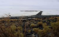
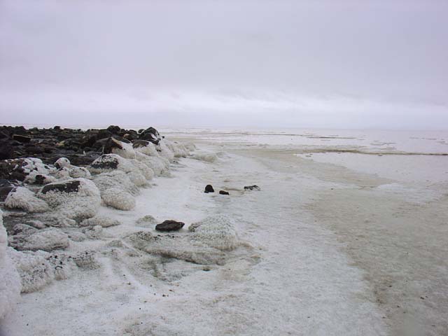
You can check the current water level of the lake at the USGS site. When we were there, the level was 4194.6. As you can see below, the water does not even reach the farthest point of the Jetty. We are guessing a more optimal level is about 8 to 16 inches higher.
If the water is much higher, while you can still see the jetty, walking out on it will surely mean wet feet. As a guess, a level 24 inches higher will make most of the Jetty submerged.
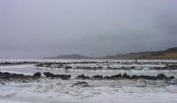
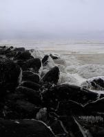
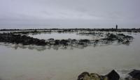
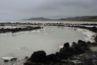
During our visit, the spirals were separated by soggy salt and a shallow cover of rainwater. The low water did make it possible to walk on the firmer salt along side the rocks instead of having to hop from rock to rock as is the case with higher water.
The Experience
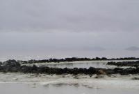
The light steady rain added a surreal atmosphere to our visit. The grey sky merged nearly seamlessly with the reddish grey lake water, the horizon almost indistinguishable except for the few distant islands floating in the void, perfectly symmetrical by way of reflection in the lake water.
Walking out on the Jetty was oddly compelling. Each step brought a slightly different perspective as we wound around towards the center. The constantly changing light added to the variety. There was a perceptible energy at the center of the spiral, perhaps from the energy expended getting to that point, going round and round, without really going anywhere at all.
-- gm
The Spiral Jetty (1970), by Robert Smithson is an early prime example of Earthworks sculpture. It is located on the North shore of the Great Salt Lake in Utah, at Rozel Point. For many years it was completely under water. A couple years ago we learned that a change in lake water management (something about the railway levee acting as a dike and disrupting the eco-system) and/or a long running western drought has brought the work seasonally above the fluctuating surface. Fall is often a good time to visit as the water level is down, the roads are usually dry, and the weather is cooler.
We planned to go this fall, even though the dry summer meant the lake had long ago dropped below what we felt was an optimal water level. The target weekend arrived with forecasts of rain and snow. This could be a problem because the site is accessible only via rough high desert back roads, which might be impassable when wet. Knowing that forecasts are often wrong, and not having another free weekend before winter sets in, we took a chance and drove to Salt Lake City.
Arriving midday Friday, we entertained ourselves at our favorite restaurants and shopping for items that cannot be purchased where we live. The next day, before setting out, we stocked up on fresh fruit at the Farmer's Market, our last opportunity to buy local summer fruit. While the weather was overcast and threatening, it was dry. We headed North towards Ogden. Soon, it started raining, then snowing. It wasn't looking too promising. We decided we could visit the Golden Spike National Historic Site as an alternate activity if the Jetty could not be reached.
Since one passes Golden Spike on the way to the Jetty, we enquired there about road conditions on the way to the Jetty. After dire warnings of doom from the Park Service staff, we decided to just poke around at Golden Spike and take the rail bed driving tour. As we were about to purchase the little tour booklet, we were informed the tour "was closed due to snow." This was odd, as the valley was clearly snow free, though there was snow quite low on the surrounding mountains.
It being not even lunch time, we decided to drive towards the Jetty to the point where the road condition first deteriorates, just to see how bad this portion was, knowing it gets worse the closer you get. Turns out, this 'bad' class D road is a perfectly serviceable all weather gravel road where one could easily drive 40 mph. We got within 3 miles of the site before the road condition changed. Even at this point, it didn't look too bad, as the road still had evidence of gravel being put down many years ago.
It appears the Park Service now has a policy of discouraging visitors to the Jetty site because if some bonehead gets in trouble, the Park Service gets stuck having to rescue them. Understandable, but misleading visitors is not winning them any goodwill points either. In our opinion, considering that we are talking about un-maintained back roads, in the rain, the conditions were rather good. The following is our take on the road conditions, but keep in mind it is just our opinion of what we experienced that day, conditions can change quickly with time and weather. Also, it depends on your frame of reference. We encountered some naïve art lovers who had inappropriately parked their vehicle, blocking the entire road leading to the Jetty, because they felt the road was 'impassible.' On the other hand, we felt the very same road was easily passable, if a little rocky. It's all relative. We have traveled on many back roads, a few rather challenging for us, more from our intolerance of endless jostling than by our Toyota Tacoma's off-road abilities. Never the less, we are a far cry from serious Jeepers that come bucking for a challenge anytime someone deems a route somewhere impassible.
The following comments are annotations of the Dia Art Foundation's directions, you will need to refer to them for our annotations to make sense. There are also signs marking the way, keep an eye out for them, they are not overly obvious. The return is less well marked, so you should note how you approach each junction so you know how to retrace your route without having to locate signs facing the other way. The time from Golden Spike is 30 to 45 minutes, mainly depending on how fast you drive on the gravel portion.
This is based on directions accessed July 2011, they seem to change from time to time, so our annotations
may no longer correlate with theirs. Also remember our observations are from 2007, conditions could have changed drastically since then.
Dia direction #5. This instruction is abridged from the original that we had followed, the portion removed said something about turning left 1/3 mi after the fork previously mentioned in Dia direction #5 onto a class D road. We're not sure what a class D road is supposed to be, but in this case it is an infrequently graded all weather gravel road. It did have a few very minor soft spots that day. I doubt that it gets plowed, so getting caught out during significant snow accumulation could mean your vehicle will be stranded for a long time. This fork is one of those triangle junctions you often see on backroads, so it's a matter of interpretation on whether this is one left or two nearby lefts.
Dia direction #11. The remaining road to the oil jetty is not that bad. Someone had laid down gravel at some point in the past, so it has not deteriorated as bad as a plain dirt road might. In dry weather it should be passable by two wheel drives with modest clearance. If you do not have four wheel drive, you should not travel alone, or at least you should be prepared for self extraction. There are two spots with significant water holes in the road where people have made alternate tracks around them. These are fine in dry weather, but in wet weather, you might be better off driving through the water holes, which may have a firmer base at the bottom. (high clearance 4WD) The use tracks off to the side get very slimy when wet, and you could sink deeply if the ground is fully saturated. At the time we passed though, the soft mud was only a couple inches deep, but very slick.
Dia direction #12 The remaining two-track trail is definitely for high clearance vehicles, there are numerous embedded rocks in the track, but they are spaced out and do not protrude all that much, so in the proper vehicle, it is quite easy to negotiate, though a bit bumpy. They are volcanic rocks, which are very abrasive, so they could damage tires with weak sidewalls. The road gradient is relatively flat, so you do not even need 4WD, just clearance. Even when wet, there was enough sand in the soil to support vehicle weight and provide adequate traction.
The track is not as narrow as the directions lead you to believe. Full size pickups will have no difficulty, you will only scratch your vehicle if you do something stupid. But remember, vegetation may have encroached into the track more than we saw in 2007. Don't blame us if your car gets a boo-boo.
Remember to follow all back road travel precautions, bring plenty of water, fuel, food, clothing, etc. Travel with other vehicles or be prepared for self extraction. Be self reliant, do not count on outside help.
Dia direction #5. This instruction is abridged from the original that we had followed, the portion removed said something about turning left 1/3 mi after the fork previously mentioned in Dia direction #5 onto a class D road. We're not sure what a class D road is supposed to be, but in this case it is an infrequently graded all weather gravel road. It did have a few very minor soft spots that day. I doubt that it gets plowed, so getting caught out during significant snow accumulation could mean your vehicle will be stranded for a long time. This fork is one of those triangle junctions you often see on backroads, so it's a matter of interpretation on whether this is one left or two nearby lefts.
Dia direction #11. The remaining road to the oil jetty is not that bad. Someone had laid down gravel at some point in the past, so it has not deteriorated as bad as a plain dirt road might. In dry weather it should be passable by two wheel drives with modest clearance. If you do not have four wheel drive, you should not travel alone, or at least you should be prepared for self extraction. There are two spots with significant water holes in the road where people have made alternate tracks around them. These are fine in dry weather, but in wet weather, you might be better off driving through the water holes, which may have a firmer base at the bottom. (high clearance 4WD) The use tracks off to the side get very slimy when wet, and you could sink deeply if the ground is fully saturated. At the time we passed though, the soft mud was only a couple inches deep, but very slick.
Dia direction #12 The remaining two-track trail is definitely for high clearance vehicles, there are numerous embedded rocks in the track, but they are spaced out and do not protrude all that much, so in the proper vehicle, it is quite easy to negotiate, though a bit bumpy. They are volcanic rocks, which are very abrasive, so they could damage tires with weak sidewalls. The road gradient is relatively flat, so you do not even need 4WD, just clearance. Even when wet, there was enough sand in the soil to support vehicle weight and provide adequate traction.
The track is not as narrow as the directions lead you to believe. Full size pickups will have no difficulty, you will only scratch your vehicle if you do something stupid. But remember, vegetation may have encroached into the track more than we saw in 2007. Don't blame us if your car gets a boo-boo.
You can check the current water level of the lake at the USGS site. When we were there, the level was 4194.6. As you can see below, the water does not even reach the farthest point of the Jetty. We are guessing a more optimal level is about 8 to 16 inches higher.

If the water is much higher, while you can still see the jetty, walking out on it will surely mean wet feet. As a guess, a level 24 inches higher will make most of the Jetty submerged.
During our visit, the spirals were separated by soggy salt and a shallow cover of rainwater. The low water did make it possible to walk on the firmer salt along side the rocks instead of having to hop from rock to rock as is the case with higher water.
The Experience
The light steady rain added a surreal atmosphere to our visit. The grey sky merged nearly seamlessly with the reddish grey lake water, the horizon almost indistinguishable except for the few distant islands floating in the void, perfectly symmetrical by way of reflection in the lake water.
Walking out on the Jetty was oddly compelling. Each step brought a slightly different perspective as we wound around towards the center. The constantly changing light added to the variety. There was a perceptible energy at the center of the spiral, perhaps from the energy expended getting to that point, going round and round, without really going anywhere at all.
-- gm
